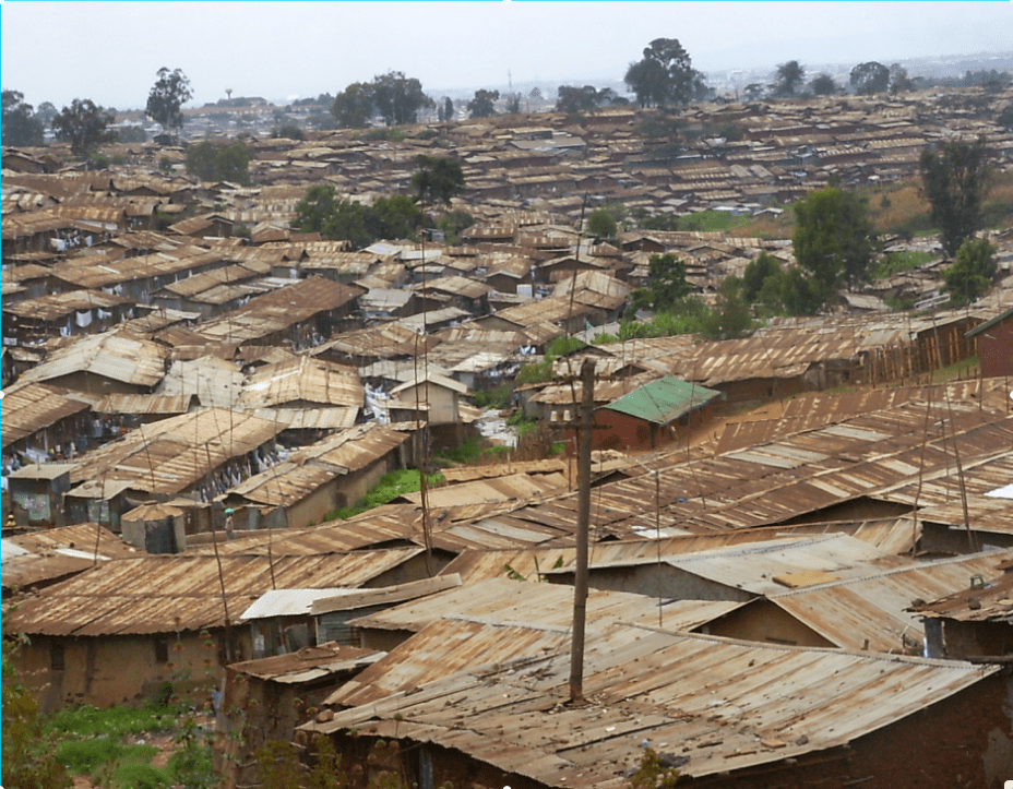
Eradicating poverty by 2030 is one of the United Nation’s sustainable development goals. Over the last few decades, Africa has eeked out a poverty fueled reputation. Charities and organisations have laboured the point and media outlets often only speak of the wars and famines, leading to many to believe that that whole continent is ravaged by poverty. Whilst there is another side to Africa, poverty does sadly remain a problem. Extreme poverty is measured as people living on less then $1.25 a day.
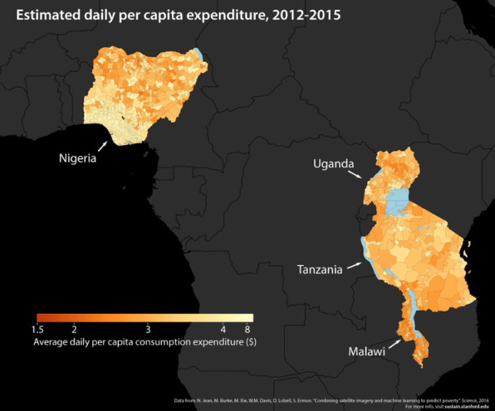
Inventive Africa discusses innovation and technology because of the belief that these changes will drag much or the continent out of poverty. Whether it is crowdfarming (#cowfarming), cooperatives to buy tech for farms, solar storage solutions, or mobile phone uses for health care, tech and innovation are offering solutions and new opportunities. But, how do you track poverty. It is important to know where the most severe poverty occurs in order to focus solutions but it is impractical to survey a whole continent. A team of U.S researchers, from Stanford University, have come up with a solution that uses artificial intelligence to recognise signs of poverty from satellite images using “a process called machine learning”.
Currently, night photos can be used to gain a rough idea of areas that contain higher poverty due to the amount of light in an area. This method is not reliable as many areas will appear dark even when there is a little electricity in the area. The new system uses night time image data in conjunction with high definition day time photos to learn about varying degrees of poverty. This learning can then be used to predict poverty in areas that appear completely dark in night time images. Burke, assistant professor in Stanford’s Department of Earth System Science, said “the computer learns to find a lot of things that we think are correlated to poverty like roads, urban areas, farmlands and waterways”.

For example, imagine the difference between a village that sits beside a main highway between two cities and one that is a few kilometres down a rough track away form the main road. This village will be able to take advantage of passing trade. Offering places to refill petrol, eat, drink, sleep or buy groceries. The village may still be in an area with little or no electricity, but they have a captive market which can help their micro economy. Thought the other village has access to the same amount of electricity, it will find it harder to grew its local economy by accessing the passing traffic. The pictures at night time may look the same, but the reality is very different. This is a simple example, but this technique is far further reaching. As you can see below, it enables a detailed view of entire countries, and eventually Africa and the world.
Why is this useful? Africa Governments and charities are in a war against poverty, but do not have the data to fight it efficiently. In order to place infrastructure, such as health centres, schools, roads, or support farmers with technology, they need up to date information on poverty. This information will outline to charities and governments where the poor are living and what they need.
This brings us back to the beginning of this post. It is uncomfortable to write first about how the poverty stereotype damages Africa and then talk about poverty in Africa, but this technology enables us to differentiate between the rich and the poor and every other strata in between. We need to fully understand the problem before it can be solved and before charging in trying to empower certain areas when others are more in need.
What other effective methods do you know to track and solve the poverty question? Please comment, like and share the blog on Twitter and Facebook. @inventiveafrica
